Bike
Fork Mountain Trail Shuttle - Mountain Biking
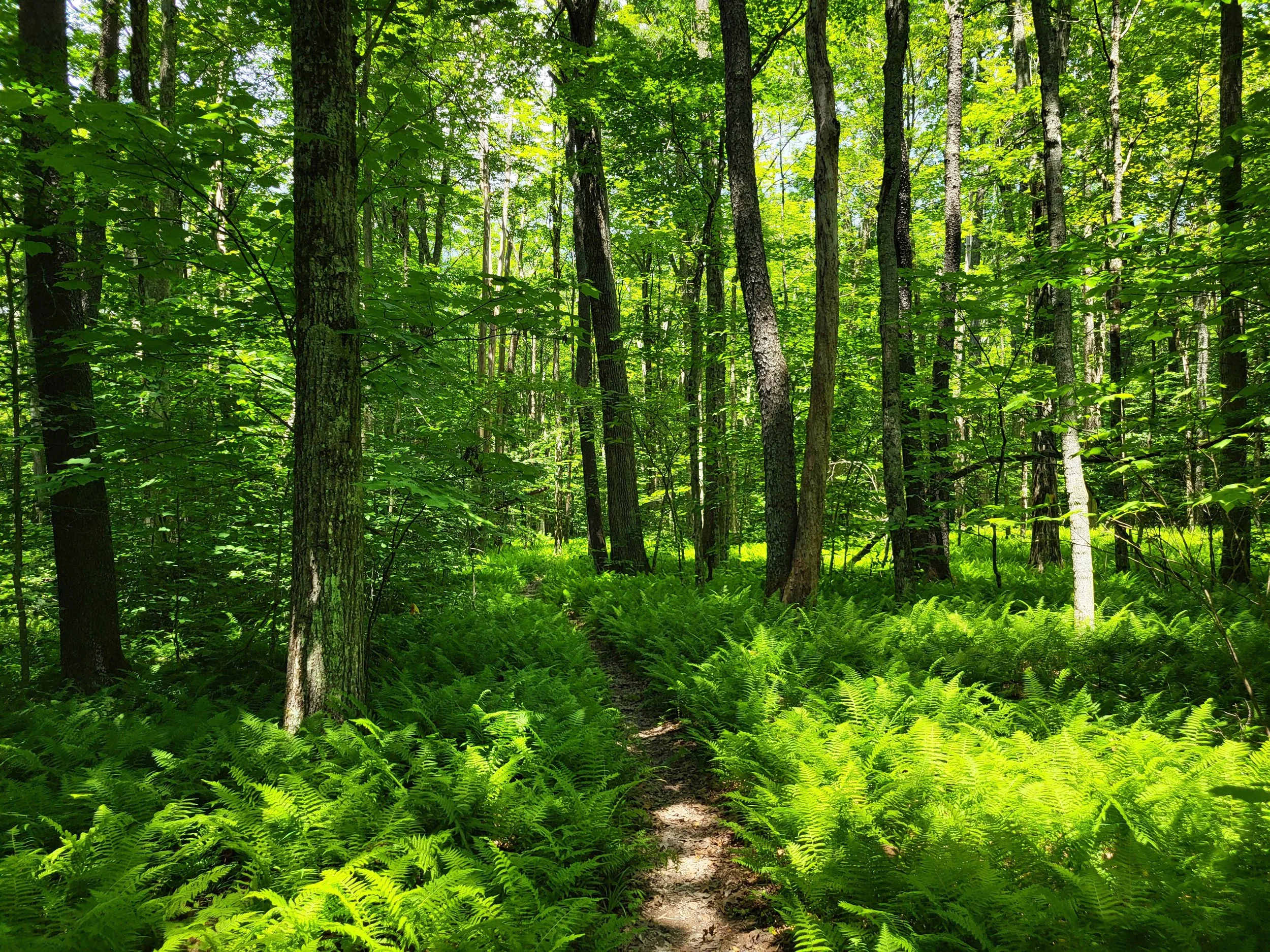
If you are bringing multiple vehicles that are able to haul bikes, you could set shuttle and bike the Fork Mountain Trail! This is a ridge ride that has more downhill than up as it encompasses the western 13 miles of cleared Fork Mountain Trail. It was once an old road that has constricted into a great singletrack. It's still possible to see the stones that were hand laid during the CCC days.
As it follows the ridge, the trail travels through several rhododendron tunnels, so June and the Fall are some of the best times to ride. The remote area has a quality of solitude and adventure. There's essentially no cell phone service or easy ways off the trail, so come prepared.
You can escape down Big Run or North Bend trails. Big Run is 6 miles in from Bear Run Road and can make a loop. Big Run is a technical downhill (in the drainage ditch) and has a blue variation that bounces back and forth around the drainage ditch called "Pin Ball Wizard". North Bend trail is 13 miles in. North Bend is a fun and fast downhill.
Continuing past North Bend, there is a nice series of smooth waterbars in a downhill section before Desert Branch (gravel) road. Can exit left there to Richwood or cross the gravel road and continue down to the Gauley Ranger Station area on Hwy 39.
As you pedal you may have the honor of seeing bear, wild turkey, deer and other species. Climbs are relatively short but can be punchy. The trail also features about six rock gardens for a nice rugged and technical feel.
To access the top of this section of the Fork Mountain Trail, riders can pedal or shuttle Highway 39 and then take Bear Run Road to reach a convenient starting area. The Richwood Visitor Center makes a good place to park or leave a recovery vehicle. Currently, the section of trail beyond FSR #946 (called Fork Mtn trail - Desert Branch section) has 2 new bridges. This version is rideable now with a reroute around the beaver pond. Alternatively, at the road, simply follow it left to descend back toward Richwood.
Cranberry Tri-Rivers Trail - Rail Trail
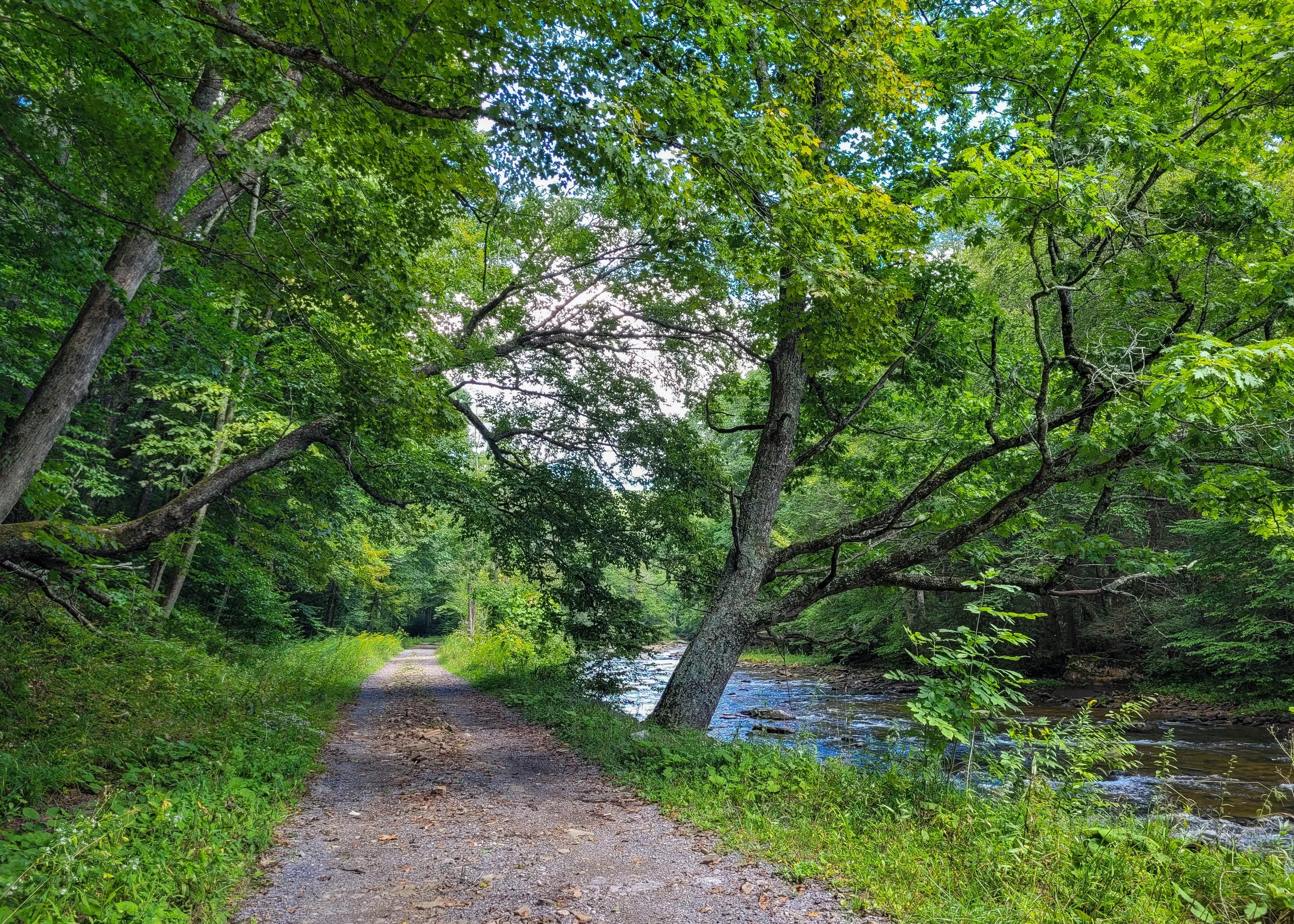
Start this out and back ride in Holcomb just outside of Richwood and ride north along the Cherry River. This will eventually bring you to the Gauley River at Curtin. There are plenty of spots along the way if you want to stop for a swim or bring some lunch with you. This trail continues up the Gauley a long way, just keep track of how far you have gone and make sure you have energy and supplies to get back to your car!
Dogway Fork or Cranberry Wilderness Shuttle - Forest Road
If you are bringing multiple vehicles that are able to haul bikes, you could set shuttle and bike into the Cranberry Wilderness all on roads and going downhill! For the Dogway Shuttle start your ride on FR 232, Dogway Road. Set your shuttle at the Cranberry Campground for this ride. For the Cranberry Shuttle start your ride out the road past the parking for the Cranberry Glades trail. Drive until you get to the gate and park in the lot. You will also set shuttle at the Cranberry Campground for this ride.
For maps and more information about biking in the area click here! There is no cell service available on these rides so having a clear understanding of navigating by map is a necessity!